Eesti Eest! Newspaper delivers curated news that cut through the censorship, mainstream bias, and institutional dominance that has left society divided and misinformed. The platform allows readers to access the news that matters, particularly when it is being ignored. Updated minute-by-minute with news coverage from a diversity of publications and topics. The website may display, include, or make available third-party content (including data, information, applications, and other products, services, and/or materials) or provide links to third-party websites or services, including through third-party advertising (“Third-Party Materials”). You acknowledge and agree that Eesti Eest! is not responsible for Third-Party Materials, including their accuracy, completeness, timeliness, validity, copyright compliance, legality, decency, quality, or any other aspect thereof. Eesti Eest does not assume and will not have any liability or responsibility to you or any other person or entity for any Third-Party Materials. Third-Party Materials and links thereto are provided solely as a convenience to you, and you access and use them entirely at your own risk and subject to such third parties’ terms and conditions. This Agreement is governed by and construed in accordance with the internal laws of the State of Delaware without giving effect to any choice or conflict of law provision or rule. Any legal suit, action, or proceeding arising out of or related to this Agreement shall be instituted exclusively in the federal courts of the United States or the courts of the State of Delaware. You waive any and all objections to the exercise of jurisdiction over you by such courts and to venue in such courts. The Content and Services are based in the state of Delaware in the United States and provided for access and use only by persons located in the United States. You acknowledge that you may not be able to access all or some of the Content and Services outside of the United States and that access thereto may not be legal by certain persons or in certain countries. If you access the Content and Services from outside the United States, you are responsible for compliance with local laws. All information on this site is intended for entertainment purposes only.
Contact us: [email protected]
Eesti Eest!


Australia has renewed its nearly 50-year partnership in the Landsat program, committing $207.4 million over four years and ongoing funding.
The money will be spent on enhancing satellite ground station facilities in the central Australian town of Alice Springs, and supporting advanced new data processing and analytics capabilities.
The opportunity arose through the Landsat 2030 International Partnership Initiative, announced during the December 2023 U.S. National Space Council meeting.
There have been nine Landsat satellites since 1972, of which eight are operational today. Landsat Next will add three more with new capabilities. As a result, partner countries will get more data more often, and at a higher resolution.
3 New Satellites Added
The Landsat Next program will consist of three satellites operating in tandem and is planned for launch in the early 2030s. It will consist of three identical observatories sent into orbit on the same launch vehicle.
They will be spaced 120 degrees apart at an orbital altitude of 653 kilometres (406 miles), allowing their respective trajectories to cover the entire surface of the Earth. The enhancements to the new satellites mean they will collect about 20 times more data than their predecessors.
For more than 50 years Landsat has provided the “longest continuous space-based record of Earth’s land in existence.”
Assistance in Emergencies
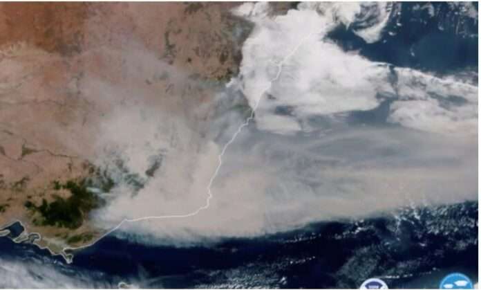
And during the Black Summer megafires of 2019/20, the worst bushfire season New South Wales has ever recorded, Landsat images were critical in predicting where the bushfires would be worst, and assisting in real-time response.
The new commitment builds on what Australia already does—the ground and data segments of Earth observation satellite systems. In fact, the country is a world leader in Earth observation data management.
Australia has an ideal geography for collecting data from the satellites via large dishes in Alice Springs, and a longstanding tradition of being the data custodians and stewards for its U.S. and European partners.
The Landsat Next agreement fulfils one aspect of the planned National Space Mission for Earth Observation (NSMEO) which was cancelled last year due to major budget cuts.